Loose Ends

Oct. 23rd, 2020 11:09 am
waitingman: (Australia)
For anyone curious... on Day 11 of the road trip, we drove back to Sydney, had lunch with some family & went home

Total kilometres travelled: 4,100

Not much else to report this week, which is why I have missed a couple of days... I was sitting in front of the computer trying to come up with an entertaining way of saying "Not much happened" & just couldn't be bothered. Was notified of a couple of job application failures, applied for a couple more & have done my best to tolerate the situation I'm in. A birthday dinner with immediate family that only served to highlight the gulf between generations... we finally reached the end of the wonderful TV series Gotham & had dinner with another friend whom we haven't seen for most of the year

North Head - part of Sydney Harbour National Park & one of the famed 'Heads' at the entrance to the Harbour, had fire run through it last weekend, after a "controlled" hazard reduction burn jumped its containment lines & turned into quite the hazard for humans & animals alike. Seeing the fire & its orange glow from the end of our street on Saturday night, was hopefully not an augur of the Summer to come...

Eucumbene River II by Justin B. on 500px.com
waitingman: (Australia)
Eden to Shellharbour

An early start, so we could be on time for our morning oyster tour on the Pambula Lake, just north of Eden. We found one of the 2 open cafés in town & picked up a light breakfast, as we knew there’d be more food during the tour - of the oyster variety!

Only a short distance north of town was the boat ramp for the lake, so we parked & waited for Captain Sponge, so his Magical Oyster Tour could begin. Yes, that’s his name - given to him by other oyster farmers on the rivers & yes, that’s what he calls his side business of taking tourists around the oyster beds & gathering spots on Pambula Lake & then down the Pambula River closer to the ocean. I still think he should call it the Magical Oystery Tour, but maybe he's more of a Stones fan...

We’d actually tried to take the Captain’s tour a couple of years ago, but the motor in his boat seized up & refused to budge us from the landing dock, so he sheepishly fed us some oysters & refunded our fees. We told him we’d come back... we just didn’t know it would be 2 years before we kept our word. Anyway, here we were & here he was, in the same boat, at just after 9am. 8 of us were on the tour, which made us relatively Covid safe, as there was enough room for us to be sufficiently distant. Julia & I held our breath as the Captain engaged the gears &... the boat moved off into the lake!!

Pambula Lake I by Justin B. on 500px.com


From there, it was an informative 2 hours around the lake & river, showing us how the oysters were caught ‘wild’, then tumbled, graded & bedded & then tumbled & graded again, at various intervals over the next 2-3 years as they grew big enough to be either a snack, an entree, or a meal. We were also in Wedgetail Eagle & Sea Eagle territory, as evidenced by a few nests high up in trees along the riverbanks & by a rather large Sea Eagle flying over us at one point. There were also several ‘middens’ of oyster shells which had been gathered, opened, then left in haphazardly stacked piles by the local aboriginal people over the last 4-5 thousand years. Amazing that a shell which takes an oyster only 3 years to grow, can still be intact after thousands of years. Will anything we build today, be able to claim the same?

Pambula River by Justin B. on 500px.com

After a veritable feast of freshly shucked oysters, lemon & pepper, we made our way back to the landing &, of course, we headed straight to the little shop attached to the shucking sheds, where we bought another dozen to fortify us for the journey up the coast today


It had been a little cold on the lake, so Laura’s heaters were switched on for the first time this trip & probably for the first time in quite a few weeks, bringing feeling & mobility back to cold hands

Probably only 20 minutes into the trip north, we started to see evidence of the bushfires which had not only ripped through Kosciuszko National Park, but had blasted through the south-eastern coast of New South Wales all through last Summer... in fact, all through last Spring AND Summer. There were blackened red trunks & stumps not only on the sides of the road, but also up on the hills & ridges. Many have regrowth sprouting from their trunks, but there were some where that regrowth had tuned brown & the tree was dead or dying. Still others were just black, with no regrowth at all. There were road crews all along the highway, most of whom were involved in cutting down the dead trees closest to the roads, as well as running repairs to rails, signage & fencing

Well, we were on our way home. The questions now were - how far did we want to go today & did we want to take any detours into other areas between here & Sydney, to postpone our inevitable return? We have a few ideas, but regardless, expect to get back to town some time tomorrow, then claim Bella back from her lodgings on Sunday, leaving us, especially me, a few days to actually relax & enjoy a bit of rest, without recreation

From oysters & seafood, then into cheese country. We had to bypass Bega, as their cheese factory is currently closed, but Tilba & Bodalla, our preferred sources anyway, were both open & tempting to palates & wallets... & tastings. So, with the travel esky more fully loaded than when we left home, we continued north


A stop in Batemans’ Bay for a seafood snack & it was decision time. Do we stay here for the night, or go a little further north, maybe to Kiama, where we’d have the option of detouring into the southern highlands, or through the Royal National Park. We decided to book accommodation in Kiama & pressed on up the highway as the sun began to sink behind the escarpment that separates the coast & the Great Dividing Range. It tuned out that our Motel is in Shellharbour, not Kiama, but it was only about 20 minutes further, so still no problem for any detours tomorrow. We'd never been to Shellharbour before - it looked to be one of the more developing south coast towns, given its proximity to Sydney, I'm sure a lot of people are heading down this way to escape everything from the Plague, to the outrageous real estate prices. Our Motel room was in another place attached to a pub, but basically comfortable enough for us

Kilometres travelled: 394
waitingman: (Australia)
Day 9 Ardlethan to Eden

Up reasonably early to see our friend off to school, then showered, packed, said goodbye to the dog, then drove about 250m to the coffee shop our friend recommended as being the better of the 2 in town. Certainly the food was nice, simple fare, but the coffee left something to be desired - like a barista who knows how to heat soy milk without splitting it & making the coffee almost lumpy & pretty much undrinkable. Julia didn’t touch hers, I made it about halfway through mine before giving up... I needed the caffeine!

Southward ho towards Wagga Wagga, a town I hadn’t visited this millennium & Julia hadn’t seen since 2005. It had certainly grown larger, for both of us & also had the first traffic lights we'd seen in what felt like ages... & it was red, of course. We stopped at the mega-mall shopping centre & were overwhelmed by the sheer number of people in the place - more than we’ve seen in any of the towns we’ve been in for the last 8 days... probably combined. We got what we needed, then got out of there as fast as we could. God knows what we’ll be like when we get back to Sydney...

Turning eastward from Wagga Wagga we passed through fields of canola - the golden (figuratively & literally) crop of the Riverina area. The colours are amazing in Spring & the fields were obviously not far from harvest time & looked almost a solid yellow colour until you got close to them. We've read recently that the farmers & local authorities are up in arms about everybody not only stopping to photograph the fields, which is fine, but many people are climbing over fences & going into the fields to take selfies crushing the crop... which is not fine... but you can be fined for it!! We, of course, just took our photos from the side of the road...

Canola II by Justin B. on 500px.com

One field farmers probably wouldn't mind you walking through is this one... While the purple flowers are lovely & a striking colour to see on a cloudy day, the plant they grow from isn't called Patersons Curse for nothing. It takes over pastures & is also toxic to livestock, so unless you get on top of it quickly, it spreads like nobody's business. We saw plenty of fields full of it & long stretches beside the road as well


After a few hours, we left the canola fields behind us & began the gradual climb into the Snowy Mountains via its eponymous Highway. Not far along, we found the little town of Adelong, outside of which were the ruins of an 1800s gold crushing plant next to what were called ‘falls’ but were really just steep rapids. The place was no less impressive for the misnomer, with the remains of the plant almost blending into the bushland by the river. Apparently, a huge flood came through about 20 years ago, destroying some of the buildings, but what's left is somehow even more of a testament to either man's determination, ingenuity, or lust for gold... Or a mix of all 3


From there, the highway twisted, turned & climbed up into mountains that still had snow on them, which stood out starkly against the denuded landscape, still very much affected by the bushfires at the beginning of the year, The huge, absolutely huge areas where all you could see was blackened stumps & trunks & barren, brown-grey ground, where it seemed even the soil had burned, was sobering & still a little frightening, to think of the ferocity of fire that could wreak that much destruction. Every now & then, there would be small pockets of bushland that seemed to be untouched by the fire, but there wasn’t much... as even those little areas had obviously been back-burned to a degree, to create a fire break against the maelstrom. There’s evidence of some early regrowth, but it’s going to take years & years before any return to ‘normal’ & decades before the scars fade

Kosciuszko Hills I by Justin B. on 500px.com


Eventually we arrived in the little town of Cooma, which we’d visited on our way back from Melbourne in December last year, just as the fires were getting started in the area & we’d threaded our way over the Snowy Mountains, between 2 fire fronts, via a dirt road that wound its way through the ranges & along the Snowy River. If we’d come along a week later, there was no way we’d have made it through - everything was on fire by then... Anyway, Cooma marked the ‘Nearly There’ point for today's travels, as it meant we were about 2 hours from Eden, on the New South Wales south coast. The temperature outside gradually climbed from the 3 degrees Celsius it had been at the top of the mountains, to a positively tropical 9 degrees, as we descended & headed out of the high country. Then the rains arrived, at around the same time as we were part of a little convoy winding down the escarpment to the coast. These things combined to slow us down a bit, so it was about 7.15 pm & dark when we eventually arrived in town - the first time we’ve done any driving after sunset on this trip. It would have been kind of comforting to have seen kangaroos, or wildlife on the roads in the area... it would mean that there still is some, after the fires...

Checked into a Motel we've stayed at before, then dinner at the Fisherman’s Club in town, strangely deserted tonight, but the school holidays start tomorrow, so enjoy the quiet while you have it...

Kilometres travelled: 551
waitingman: (Australia)
Euston to Ardlethan

A small, simple breakfast at the same little take-way shop up the road from our Motel, then a false start, due to Google mapping us to the nearest petrol station, which was on the wrong side of the border. We could have got petrol there, but would have had to wait 2 weeks before we could go anywhere with it. So, having found the 2nd nearest one, on the right side of the checkpoints, away we went, following the Murray River eastward, then as it dropped away south, the landscape became flatter & we were in big sky country again

And there’s not really much more to say about the drive to Ardlethan than that - it was a fairly uneventful day on the road, with no real photo opportunities, apart from one I only really saw as I was driving past it, but didn’t stop, or turn ‘round for... then spent the next 30 kilometres wishing I had

Being in big sky country meant we could see the rain clouds approaching from maybe about 100 kilometres away & thought initially that they’d slide past us on the right... & the initial rain bursts did just that, but the sky gradually turned greyer, then darker & then we were in the thick of it for about 5 minutes, then it would stop for 5, rain for 5, stop again... all rather frustrating really. Especially when we stopped in the town of Narrandera for a break & some pastries from the bakery & found that the rain had once again, washed off all the mud & dust we’d spent the last 2 days getting re-applied on the way down from Broken Hill. Our friend in Ardlethan will never believe where we’ve been, because all the evidence is gone...

The only stop we could have, maybe should have made, was to Altina Wildlife Park, which we saw a sign for about 200m before its gates, so we braked hard & turned left to go into the car park. What we could see from there was a lot of concrete walls & mesh fencing, which was a little too ‘Tiger King’ in appearance for us, so we elected to not go in, because if it was anything like Joe Exotic’s place, it was only going to make us angry & that’s not what this holiday is for. That’s what work is for...

We arrived in Ardlethan just after the school’s finishing time, so messaged our friend to let her know we were in town, then took a little drive round to see it. And a little drive is all that was needed, for a town of only 375 people. Shortly after that, we turned up at our friend’s doorstep, for an afternoon/evening of catching up, a great country pub meal (in the town's only pub) & playing with her dog. She informed us that the Altina Wildlife Park is apparently quite a good & reputable one, so we shouldn't have judged quite so quickly & it’s earmarked for a future trip down this way... She also had a lot of background information about the towns of Brewarrina, Bourke, Ardlethan & Wilcannia regarding the tensions with the aboriginal communities there & the occasionally violent & always racist treatment meted out to them by the white settlers, then the police & courts, not to mention government policies over the last 175 years or so. It's going to take a lot of communication, understanding, reconciliation, apology, one hell of an attitude shift &, unfortunately, probably a couple of generations before the wounds are healed

Kilometres travelled:404 - we ticked over 3,000 kilometres today
waitingman: (Australia)
Broken Hill to Euston

A call to the Silly Goat Cafe to book a table for 2 was answered by a friendly voice who cheerfully told me the cafe was closed until Thursday, so after a fruitless search for a viable alternative (even the one down the road we went to yesterday was closed today), it’s a McDonalds breakfast for us. At least it was also right next to the Shopping Centre & the petrol station - both places we needed to visit before leaving town

I have a vague grid of Broken Hill in my head by now, so was able to find the way to the Silver City Highway heading south without incident or any navigational help from Laura, or Jeeves - our Google Guide. Well - Goodbye Broken Hill, it’s always a pleasure to visit. I'm sure times will get better & your businesses can afford to open more often soon

Apart from a brief photo stop at some power lines disappearing in a vaguely southerly direction & the bones of dozens & dozens of roadkill animals along its shoulders, there’s not much to report about the Silver City Highway heading southward, except that it seems the Bra Tree is no longer on it. This was a tree festooned with bras, as a memorial to a local woman who died of breast cancer, but also served as a way of raising awareness of the various charities funding research & respite care. It had been pretty easy to spot on our last trip on the road & this time we were expecting it, but it’s gone... the highway is a less colourful & slightly less silly place without it

The Bra Tree

Edit Update: Apparently, it is still there, at least according to Google, anyway. So maybe we just missed it... Here's a picture of it from 2014

The other thing we were expecting to see this time was the Perry Sandhills - a place we completely missed last time we travelled down this highway, only discovering their existence long after we’d gone past them. So this time, the hills were firmly on our radar. It turned out they were only a few kilometres outside the town of Wentworth & a quick right turn off the highway brought us to them, again without any navigation assistance... you can actually see them from the highway, so don’t ask how we’d missed them the last time...

We did think they’d be bigger though... According to the little information board, the sandhill area is about 7 square kilometres. To my mind, it looked like a giant sandpit, or the dumping ground for a future concrete construction, before the cement trucks arrive

Tell you what though... it’s quite a big area when you’ve climbed, stumbled & staggered up the tallest dune & are making your way across the hills in the blasting wind & trying to shield your camera from the sand that it whips up. But it’s amazing... a little slice of the Sahara only a few kilometres from the conjunction of the 2 biggest rivers in New South Wales... more on that in a minute

Perry Sandhills I by Justin B. on 500px.com

In the middle of the hills, is the ‘God Tree’ - a 6-700yr old ghost gum whose trunk has been gradually buried under about 6 metres of sand, so only the canopy is above ground... & the canopy must be at least 10 metres high. The main branches are incredibly thick & where they converge at the buried trunk, it reminded me of the sequoias in Yosemite Park... under that sand must be one massive trunk!!


Aboriginal people in the area used to hunt the prehistoric megafauna here - bones have been found of Diprotodon, a giant wombat, Thylacine tigers, as well as the older, larger ancestors of today’s kangaroos, who to my mind, are quite big enough... ever seen a fully-grown male red kangaroo? The tribes used to take shelter on the hills when the 2 rivers flooded, as did the early white settlers of the area

We took Laura on the dirt road that doesn’t quite encircle the sandhill area, to give her a chance to engage the 4 wheel drive & to get some new mud to show off after I found a few puddles that, somehow, were unavoidable. No, really, they were... Then back on the highway for the last couple of kilometres into town & down to the joining point of the Murray & Darling rivers. The Darling flows down through central & western New South Wales - we’d actually crossed it a couple of times in the last few days as we were heading in the same direction - & the Murray has its origins on the Snowy Mountain range in the south-east, then flows westward until it reaches the Southern Ocean over in South Australia. The Murray is also the official border between NSW & Victoria for much of its course, so at this point, it was as close as we were going to get to travelling interstate, since our visit to Cameron’s Corner was washed out


The Riverina region, as this area is known, is primarily flat, fertile plains - probably floodplains back when the 2 rivers really got going, which sadly, hasn't happened here for a looong time. The place is so flat, we could see oncoming traffic about 1-2 minutes before it got to us. In the case of the larger road trains, it was occasionally longer. It made for an entertaining game - seeing how long it was between first spotting a vehicle, to having it finally go past

We already knew that there was no accommodation available in Wentworth, so had booked a room in a town we’d previously never heard of - Euston, about another hour or so along the highway. It had the dual advantage of being on the right side of the Murray &, more importantly, had a Motel with a room available. Quite a nice room too, with a view of & access to the river via a sliding back door, as well as a short walk to the local take-away food store & bottle shop. Dinner - sorted. We ate at the little table just outside our room, looking down onto the Murray River to make sure no Victorians were attempting a river crossing over the border. If we'd seen any, there was a Highway Patrol officer in the room next to ours & another a couple of rooms along - their cars were parked out front. Later on that night, we heard them leaving, obviously on night shift. The patrol car engines were so loud when they fired up, I'm pretty sure the whole Motel heard them leaving!


On to Ardlethan tomorrow, an even smaller town than Euston, but one I’ve at least heard of, mostly because an old friend of mine is the Head Teacher at the school & we’ll be catching up with her when we get there...

Kilometres travelled: 450
waitingman: (Australia)
Broken Hill, Silverton, Mundi Mundi

One thing you need to know about Broken Hill on a Monday... it’s like Bourke on a Sunday - everything seems to be closed, so the few places that are open for breakfast, are in high demand. So, no breakfast for us at the Silly Goat café, but a quite acceptable substitute 50m down the road at the next one

Some sight-seeing today, not something I’ve ever done in Broken Hill, but L-SP has, so she had a list of places worth seeing, starting with the Line of Lode Miners Memorial at the top of the broken hill itself. This was under construction last time we were here, so a first for both of us to start the day with. It’s a memorial to 817 miners who have died in the mines since they started in the late 1880s. The structure itself is in the shape of the mineral lode under the hill & lists the names of the miners, as well as how they died - everything from asphyxiation, falling down shafts, explosions, run over by machinery... & one poor guy who fell off his bike. It’s telling that as the 20th century ticked over, the numbers decrease year by year, especially as the miner’s union movement won more & more concessions on working conditions & safety regulations, to the point where the last recorded fatality was in 2008 & there was only one that year, compared to dozens in the mines early years


Speaking of those early years, our next stop was White’s Mineral Art Gallery & Mining Museum, on the western outskirts of town. This is run by an elderly couple who have collected a huge array of mining equipment from the last hundred years or so & have arranged it in a gallery that they’ve designed to look like a mine shaft. Any spare space on the walls is filled by mineral sand paintings done by one of the owner’s older brothers - now deceased (which is not that surprising, as the owner himself must be in his mid 80s at least). The paintings are done by taking a photograph & then grinding various minerals to a fine sand, or powder in various colours, then it’s kind of like painting by numbers. Lots of works depicting the mines & miners of course, but a surprising selection of other topics - including various biblical scenes. Not sure where he got the photos of those from...

Next, to the Flying Doctors base out at the airport on the other side of town. Begun by a Methodist missionary after the First World War, they fly doctors & nurses throughout regional Australia, dealing with everything from births, accidents, cancer & dentistry, landing on everything from bush airstrips, to a flat enough paddock. So not only do you need to be across multiple medical disciplines, you also need balls of steel... & that goes for the women too


Back to town for a quick late-lunch break & to discover that the bookshop we wanted to visit was, of course, closed on Mondays. So, next was a trip out to Silverton, about 20kms north west of town &, as the name suggests, an old silver mining town founded about 5 years after Broken Hill. It’s also famous for having been the central location for the Mad Max movies. A few artists have moved out to the area as well, obviously finding the hustle of Broken Hill too much for them. Last time we were here, it was an overcast day, which today certainly wasn’t, so the light was pretty harsh, but certainly a nicer day to be wandering ‘round the town. There's a Mad Max 'museum' in the town, which we didn't visit last time we were here & didn't this time either. We did wander through one of the places styling itself as a museum, which was interesting from an artistic point of view - as there were a lot of paintings by Howard Steer, a Broken Hill painter whose work is highly stylised & the kind of thing you either like, or don't.... The Gallery owner wasn't very chatty, but his dog was friendly


The landscape of the town is littered with old mining houses & some 'half-houses' - which was a house you could build half of & live in while you tried to make enough money to build the other half. Some never did & these days, there's about half of the half-house still standing...

Silverton Resort
One from 2014, when we were last here... a better photo than I managed this time!


From Silverton, it’s a short drive out to the Mundi Mundi Plains - a vast open space that extends out to the South Australian border & the desert beyond it. The place is so vast, wide & flat, it’s been said you can see the curvature of the earth. Perhaps this is the reason the lookout location was chosen today by an aspiring young rock star to shoot video footage for his new single. He & his team arrived at the lookout about 2 minutes after we did & set themselves up with lights, cameras, a drone & a boom box which belted out the song about half a dozen times... something about how his girl has left him because she’s not ready for love. Dressed in black & striking anthemic poses against the flat, but stunning landscape - U2’s photos & videos in the Joshua Tree desert back in the 1980s have a lot to answer for

The sunset was cloudless & given the absence of any landscape features, it was a tricky one. Only when the sun was touching the horizon & its light had dialled waaay down, could we get shots that featured the landscape as well as the sky

Mundi Mundi Sunset I by Justin B. on 500px.com

Back to Broken Hill & we decided, after having driven past the place about 4 times over the last 2 days, to go into the Musicians Club. It turned out to be less of a haven for players of instruments & more of a lesser RSL, or sports club. But the bistro menu had enough appeal & the drinks were cheaper than the other places we’d been, so dinner it was

Afterwards we took a drive back up to the Miners Memorial, to see if it was lit up at night. It wasn’t... well, not until Laura’s high beam headlights hit it, but that wasn’t good enough for a night shot of the place, so back here to the Motel, as we have another long day in the saddle tomorrow. As we arrived, guess whose car was in the Motel carpark? Definitely time to go then...
waitingman: (Australia)
Bourke to Broken Hill

A short conversation this morning with the Motel owner’s dog, then a shorter one with the owner himself, who actually lives in Sydney, about 15 km from us, on the Northern Beaches (Now that's one hell of a commute to work!!). We were impressed by the pre-fab cabins he'd installed for the accommodation & picked his brains a little for a possible future project... Then we went to try & find somewhere in town for breakfast, which is a bit of a tall order in Bourke on a Sunday morning apparently, as everything other than the Newsagent was not only closed, but mostly shuttered as well. Given Bourke’s reputation as the most mad, bad & dangerous place to be in New South Wales (I thought that would have been Wilcannia...) I suppose it’s not surprising, but it did leave us with a coffee-shaped hole in our morning, which was only sort of filled by 2 cans of cold-press coffee Julia had brought for just such an emergency. This at least got us going on the road to Cobar. It wasn't only the cafés that were closed in Bourke, even the Pubs looked to have given up...


All bitumen, all the way to Cobar, so no new mud for us... Laura is starting to look like we just left the car dealership. From the front, anyway

That was until we hit our 2nd bird for the trip, about 30 minutes outside Cobar. It was bound to happen, as flocks of birds were so frequently taking off from the roadside, then flying over & around us, that it felt like a remake of ‘The Birds’- or some kind of sequel, where Laura takes revenge

The town of Cobar hadn’t changed much since we were last there in 2014, except that the Visitors Centre had temporarily relocated, while its building was being ‘refurbished’ by the State Government - so it could be in its new digs for a while. Outside the proper building, we met 2 chatty women who were on their way to Broken Hill, one of whom was from Bankstown in Sydney. When Julia mentioned the good Vietnamese food available there, she just completely shut down the conversation with a half-hearted comment about good food stalls, of which there are none in Bankstown - either Vietnamese or any other cuisine. obviously two of those Australians who have not only failed to embrace multiculturalism as a sensible & compassionate way forward for our Country, but also haven't developed their palate beyond pies, sausage rolls, fish'n'chips & a beer... Time to go then

So off to the new 'temporary' Visitors Centre, to check on the state of the roads to & around the top Corner. The lady behind the counter was highly amused when I asked her to tell me something different to what the Centres in Lightning Ridge, Brewarrina & Bourke had all said... & no - the roads are all still closed, so it looks like the Corner is definitely off for this trip & priority #1 for the next one... whenever that is. While we were receiving this news, who should turn up at the Centre but the women who obviously don’t eat in Bankstown because of all the foreign food. Time to go then

We drove past the cafe we ate at the last time we were here... & it was closed. Don’t tell me Cobar has gone all Bourke on us? No... we found a small bakery cafe that had either pies or fried chicken & coffee!. Now all we needed was for our Bankstown stalkers to turn up. This fare was right up their alimentary canals... Just as we finished eating, guess who?? Time to go then

But first, some fuel... then out onto the Barrier Highway, bound for Broken Hill. Once you leave Cobar, the landscape becomes a lot redder, the vegetation shorter & gradually sparser & you feel a lot closer to the desert

Except when you drive through large pools of rainwater across the road at 110 km/h, which is definitely not a desert feature... there was obviously a LOT of water in that storm we saw last night, as there was also lots of water on the side of the road as we headed west. There were also a lot of herds of wild goats, who at least had the road sense to not run towards Laura as we passed by, unlike what kangaroos, lizards & yes, birds, tend to do

As mentioned previously, I thought Wilcannia has the perpetual award for maddest, baddest & most dangerous place to be in New South Wales & that’s what I’ve known for at least 25 years. I’ve passed through the town twice before & never stopped there - having always made sure I had enough fuel & whatever to just keep going. Julia had done the same when she’d passed through on a solo road trip back in the day & we saw no reason to change 2 lifetime’s habits, so we slowed down to 50km/h as we drove in... avoided running over the 3 delinquents walking down the middle of the road, then accelerated to 110km/h as we hit the town limits less than 90 seconds later

As we got closer to Broken Hill, the amount of water over the landscape began to look like the beginnings of an inland sea in places. We would have thought that after years of serious drought, such a parched landscape would have just soaked up the water like a sponge, but either that’s not the way the geography works, or there’d been a LOT of water in that storm!!

Inland Sea III by Justin B. on 500px.com


We got into town at around 4.30pm local time & found our Motel on the same road we’d driven in on, which was both good & bad, as there are a lot of trucks that drive in the same way. Here’s hoping for double glazing? But before that, here’s hoping we could get into our room, as Reception was closed up & it took 2 phone calls to get hold of the Owner, who gave us the code to a safe box next to the office, which contained an envelope with my name on it, inside which was a receipt & a keyring. Not until I’d hung up & we’d walked over to our room did we discover that the keyring had no key on it... So another call to the Owner, who was on the other side of town at her other Motel, but would be with us in about 5 minutes... Not that we weren’t in need of a bathroom or anything, after a few hours on the road & the coffee had kicked in, or anything. Oh no... not at all

Once the key situation was sorted & ablutions performed, we decided to head west of town, out to the Living Desert Sculpture Park for sunset. Here, arranged on a hilltop, there are large, rough-hewn sculpted pieces of red rock, done by local indigenous & international artists in a variety of styles & when the evening sun hits the rock, the artworks light up quite beautifully, as we’d found when we were last out there in 2014

Here also, this time, was a carpark full of SUVs & people getting out deck chairs... those who hadn’t already gone to the top of the hill & were staking out their sunset viewpoints - most of them amongst, or in some cases, right next to the sculptures. I don’t get it - why would you do that?!? The whole point of the place is to see how the light changes the artworks' characteristics & appearance - hence the whole ‘Living Sculpture’ thing. Exactly how is that improved or enhanced by you parking your backside on a foldout chair right next to, or in front of the pieces, where not only can you not see that interplay of light, but you completely ruin anyone’s chances of capturing that effect on camera, or even just the general experience of it, by squatting there without a thought, or care in the world for anyone else. Why certainly... we’ve just driven hundreds of kilometres today & come up here specifically so we can take a family portrait of you & your wife/husband/2.5 children all squinting into the sunlight

Sculpture Sunset I by Justin B. on 500px.com


Anyway, it forced us to get creative with angles & framing, but it was still hard to not smack a few people across the head when they heedlessly walk into your shot & stand there, take out their phone, take their snapshot, then conduct some epic text exchange, while behind them, a piece of a photographer’s soul is dying...

Once the sun dipped below the horizon & there weren’t enough clouds to get a good afterglow effect, we headed back to the carpark to get the jump on the masses & drove back to town, with dinner in mind. Having had the traditional pub meal last night, something simpler & easier was needed, so Subway it is... with a quick stop at a bottle shop for a couple of cans of Guinness. Then back to our Hotel where we’ve eaten, caught up with the TV news, as well as a couple episodes of Border Security. As I’ve been writing this, Men In Black 2 has been on TV & even though we own it on DVD, there was no move to turn it off, so this entry has probably taken much longer to write than it should have...

Kilometres travelled: 641
waitingman: (Default)
Lightning Ridge to Bourke

An overcast morning. Oh oh...


Well, we tried to find a different café for breakfast, so we could spread the love (& money) around town, but we would up at the same place as yesterday, which wasn’t necessarily a bad thing - we could get a table & the soy coffee was good... we don't really ask for much more than that. Then back to the Opal Cave - the store we visited yesterday, where we were welcomed back enthusiastically, or at least our wallets were... okay mine... to pick up some earrings... okay, 2 sets of earrings. Okay & one of the purple hemp shirts on the wall... The owner - an octogenarian named Herman, took a shine to both of us, & ended up telling us his tale of woe regarding a disgruntled client of a few years back, who has been cyber-slandering both Herman & the shop, causing grief & apparently a 30kg weight loss in Herman. Having found out that Long-Suffering Partner works in IT security, he now depends on her to take down this guy’s defamatory website &, having found out I’ve been in Sales most of my life, he offered me a job to take over from him when/if he retires. Something about his manner suggested to me that he makes that offer to a lot of people who come into his Cave. I personally think he’ll probably be carried out of there in a pine box... encrusted with opals, no doubt. The amount of time we spent in there talking with this charming man, made me wonder if we’d leave the same way...

Having made our escape, we headed to the Visitors Centre, to see if there was any advice they had for getting to Bourke via Goodooga, as we didn’t want to backtrack to Walgett. They were a bit uncertain about the condition of the dirt roads & ended up calling the Visitors Centre in Brewarrina, to see if they had information on the road status &, as the news seemed to be good, we filled up with diesel & headed north, by north west

30 kilometres up the highway was the turnoff for Goodooga, a town I only know because an old friend of mine taught at the school there for a number of years. As we got closer to the town, the grey skies above began looking more like rain clouds, with a few drops falling as we took a couple of photos outside the school to send to my friend, letting her know I’d finally made it up there to visit & where the hell was she?! Where she is, is down in Ardlethan, a town on the Victorian border in the Riverina region, where she’s been for a few years now (I knew that!!). As fate would have it, we’ll probably be passing through the Riverina in about 4-5 days, so we’ll most likely catch up then

Leaving Goodooga, the first thing we discovered was that the main road from there to Brewarrina was closed for repairs. Our informant at the Visitors Centre failed to mention that! Fortunately, the alternative route was one I’d briefly seen on the map they showed us back in the Visitors Centre in Lightning Ridge & was helpfully signposted with yellow 'Detour' signs... at least it was until you got onto the road itself, which was a dirt road of dark soil instead of the red ones we’d been traipsing all over for the last couple of days around Lightning Ridge. The dark soil is softer, meaning we were sliding around a bit until we engaged Laura’s 4WD, which gave us a better ride & meant that Laura’s onboard system stopped beeping at us every time the going got a bit hairy


Then the grey sky became proper rain clouds, which stopped some more sliding, but threatened to become a mud bath instead... The dark mud clumps & sticks very quickly, so it was a relief to get off that road before we got bogged somewhere out in big sky country & onto a bitumen road where the only thing to be wary of was cattle grids every few kilometres. That's when the detour signs re-appeared, after an absence of maybe 100 kilometres or so. I had visions of us having somehow taken the wrong road, getting irretrievably bogged & having to abandon Laura out there. She wouldn't be the first, apparently...

Desert Rain by Justin B. on 500px.com


Coming into Brewarrina, the rain began falling a lot more seriously & we began to lose most of our hard-earned dirt & mud from the last few days. Seen from the front, Laura looked pristine again. Fortunately, the rear end & back window were still evidence of miles & miles of bad road. All we know of the town was what we’d read last night. - there were aboriginal fish traps on the river. We pulled into the Visitors Centre to see what else they could tell us & met the voice on the other end of the phone call made from Lightning Ridge this morning. At least she was pleased we’d made it before the road became quicksand. Almost as pleased as we were...

The fish traps were, in fact, about 200m from the Visitors Centre itself, on the Darling River that runs through the town. Our informant told us the best viewpoint was from behind the Aboriginal Museum, where there was a path down to the river right where the traps were. As we arrived, I spotted 3 pelicans floating/swimming down the river & hastened my pace to get to the bank to photograph them before they disappeared. That’s when we both discovered the path was made from the same black soil we’d been driving on earlier & not only was it now slippery as hell, but also quickly caked itself on our shoes & then everything else stuck to that - twigs, grass, small pebbles...


The traps themselves were a revelation. They are the oldest man-made structures on earth, being at least 40,000 years old & still standing & seemed to still be working, as the pelicans & a couple of egrets looked to be making use of them for an afternoon snack of fish swimming into these old stone channels which funnel the fish out of the currents & into a dead end, where once upon a time, the local tribes would then place stones at the entry point to prevent the fish swimming out, then use nets to reap the reward. The birds, being without stones or nets, still seemed to enjoy the ancient helping hand the traps provide


I love it when a motion panning shot turns out right!!

But here came the rain again, so we headed back to Laura, did our best to clear the mud from our shoes & headed out west to Bourke. Along the road we finally saw our first wild goat herds, as well as half a dozen emus. Luckily, they were all well away from the road

We arrived in Bourke during a respite from the rain, which raised my hopes a little about our desired destination of Cameron’s Corner, but this was dashed when we arrived at the Visitors Centre to enquire about the route. All roads north west of Bourke - even the main one to Tibooburra, were well & truly closed & apparently it can cost you thousands of dollars if you decide to chance your arm on a closed road, get stuck out there & need to be dug out of the mud & towed to the nearest town. Looks like the Corner will have to wait for another time, so we went & found our accommodation for the night, which turned out to be some newly built/renovated cabins behind a pub & is quite wonderful. A firm mattress, good shower & powerful air conditioning. After a short break to freshen up & some photos of the by now impressive thunderstorm passing over the town, we headed off to a pub restaurant for what promised to be the first real country pub meal we’ve had. And it was... a decent sized steak for me, 4 lamb cutlets for L-SP & that will do nicely


While we were waiting for our food to arrive, I pointed out to L-SP the cluster of old blokes standing around at the bar, all talking while drinking. Now, this is the Outback cliché of the pub at the end of the day, but in these Plague times, you're supposed to get your drink, then find somewhere to sit down & drink it. No sooner had I mentioned that if the cops came in & saw this, there'd be trouble, two uniformed police came in, walked up to the bar, ordered take-away coffees, collected them & left... Given that New South Wales Covid19 cases are minuscule at the moment & there have never been many cases reported outside the main metropolises, I suppose somewhere pretty remote like Bourke (population - not very much) never had a lot to worry about & clearly by now, simply doesn't... Having dined & wined, we headed back to our lodgings, as the storm lit up the eastern sky on its way to drench Brewarrina & surrounding locales. I’m typing this entry on our iPad out on our verandah, as the group of drunk ladies in the pub courtyard across the carpark, yell for the karaoke machine to be fired up. I think it’s time to go inside, close the door & curtains, put a pillow over my head & prepare for tomorrow

Kilometres travelled: 310, but action packed!
waitingman: (Australia)
Lightning Ridge & surrounding area

Breakfast at a local enough cafe that we could have walked to, but didn’t, then across the street from there to the John Murray Art Gallery - though it feels like the entire town of Lightning Ridge is the John Murray Art Gallery. His paintings are in just about every building, including our motel room, on a few murals around town & the Bowling Club last night must have had about a dozen of his works on its walls. Anyway, he also has a large shed with plenty more & we have to admit some of the works inside are really good!! Good enough that we bought 2 decent sized prints to take back & frame. And a fridge magnet...

Round the corner, to the Post Office to buy a packing tube for our new artworks, then into the Opal Cave shop to check out the local product. The place is run by an octogenarian jeweller whose sales banter can sail dangerously close to inappropriate, to today’s ears, but he mostly gets away with it... I assume, because he’s still there

We then had 3 more colour-coded car door tours to do. These are tours set up in & around the town & are marked with car doors of a particular colour, with hand-painted directions, or instructions on them. The Visitors Centre had given us an accompanying info sheet yesterday, in case we couldn't read the door, or maybe missed one. Even though Lightning Ridge has turned out to be a much smaller town than we expected - its reputation is probably 10x the size of the town - there's a lot to see, if the car door tours are to be believed... L-SP also pointed out that it must be hard to figure out what the population of the town is, as there seem to be more people living outside the town on their small opal 'claims', than in the houses inside the town itself. So how come Laura still managed to get us lost last night looking for a simple restaurant!!

The coloured door tours certainly seem like an interesting way to see everything the town & area have to offer, given the relative success of the one we did at sunset last night, so we started with the Blue tour, which was mostly spots around town, finishing at the Walk-In Opal Mine, which, as the name suggests, you don a hard hat & can walk into (after paying a modest entry fee, of course). Opal miners are, at least, a little taller than the Cornish silver miners who dug the mine we visited in Silverton a few years back. At least there were parts of the opal mine I could stand up in... though I still banged my hard-hatted head about a dozen times on the sandstone ceiling, or pine roof supports, or light fittings. At the end of the mine, in a little room, there was a video running on a loop which gave the history of the opal discovery, boom & even its gradual decline, though there are still, obviously, plenty of people out here giving it a red-hot go. Apparently, only 1 in 10 miners ever find a decent amount of opals, 1 in 10 of those find the good ones & 1 in 10 of those goes on to make a good living at it... Not great odds for striking it rich


Then onto the Red Tour, which took us a bit further afield & past places of interest like a couple of defunct open-cut mines, which plainly showed the layers of rock & clay the miners go down through to get to the rare opals. L-SP & I both agreed that, even though it was probably worse for the landscape, it was definitely safer than the little tunnels we'd been in an hour or so earlier...


Back into town via the ‘famous’ glass bottle house, which is another entrant in the ‘I Thought It Would Be Bigger’ files. Certainly for what they wanted to charge for entry into the building, you’d want it to be large enough to justify the price. We elected to not pay it, & just took some photos of the outside & drove on...

To the starting point for the Yellow tour, which took us quite a distance outside the town, past a LOT of smaller claim mines, another open-cut mine & eventually to a rustic old church, which turned out to have been built for the movie ‘The Goddess Of 1967’, filmed in the area in 2000. I’d heard of the film, but never seen it. Kudos to the set builders though - it’s still standing... even if its insides could do with a bit of renovation, including a new floor. Tempting as it was, I didn’t leave a business card...


The Yellow tour finished at a giant industrial statue of an emu, about 10 kilometres outside town. We’d driven past it yesterday, but didn’t stop at the time, only wondering what the hell it was. Well, now we know. Back to town via its ‘Entry Gates’ next to a large art installation which someone had decided to be buried next to. Seriously... there’s a grave right next to this big sign welcoming you to the town, with a gravel mixer perched on top of it... which kind of sets the tone for this odd little town - a mixture of desperation, both for opals & the tourist dollar & the oddball kinds of people who are attracted to the extremely long odds of opal mining, as well as the left-field creative thinkers who bring colour & life to the town, not to mention that particular, peculiar sense of humour born of long distance, isolation & hard living in harsh country


A short rest back at our Motel, then we decided to head out to the end point of yesterday’s Green door tour, where you look out west over the plains & the sun sets over the vast, flat terrain. Once again, the area was awash with Grey Nomads & their 4WDs, their camp chairs, picnic tables & Dad jokes. We foraged around the area avoiding the myriad mine holes, & slipping down the slag heaps, looking for good vantage points that were also far from the maddening crowd. Sunset, when it came, wasn’t quite as good as last night, but we came away with some nice images, so the time wasn’t wasted. Julia saw her first kangaroo in the wild (for this trip) on the way back to the main road too...

Opal Mines I by Justin B. on 500px.com

Back into town & we thought we’d try the bigger of the 2 Italian restaurants we found by incident last night for dinner. Unfortunately, so did everyone else... & they’d all booked ahead, so we contented ourselves with a take-away pizza & a white wine from the nearby ‘Bottle O’ & headed back to our Motel room for a quiet night in

Off to Bourke tomorrow, with fingers crossed that the predicted rain either doesn’t arrive for a few more days, or that it won’t make our planned road to Cameron’s Corner impossibly impassable...
waitingman: (Australia)
Narrabri to Lightning Ridge

A lesser travelled day, overall, but it certainly felt like more than just 340 kms

Breakfast at the 2nd local cafe we found, then to a pharmacy for essentials & a lottery agency for some wishful thinking, before heading back out to the Australia Telescope Compact Array about 15 kms out of town. We’ve been there before, but being mild science nerds, it’s always worth the trip. With the sun on the ‘right’ side of the dishes in the morning, it was easier to get shots of the 5 close dishes all together (the 6th is fixed at a point some 5 kms away from the others). A little science reading in the Visitors Centre, then testing out the in-line acoustic dishes, which are set about 50m apart & if you face the dish & speak, the person at the other one can hear you clearly. Be careful what you call your partner - they can hear you!!


And so, on to Lightning Ridge, via whatever we find along the way. We decided to try out Laura’s on-board mapping system again & she directed us down a red dirt road for a few kilometres, before getting her wires crossed & sending us in a couple of circles around a rail siding, before we figured out the way to Walgett ourselves. We got a little ambitious & added in the town of Come By Chance, simply because who can resist a name like that. After a bit (okay, quite a bit) of prevarication on Laura’s part, we found the right way there, thanks, in no small part, to the little town of Burren Junction. Now, I'd never heard of the place, but once upon a time it seems to have been the Grand Central station of Australian travel & freight, if the sign outside town is to be believed... You can get anywhere from there


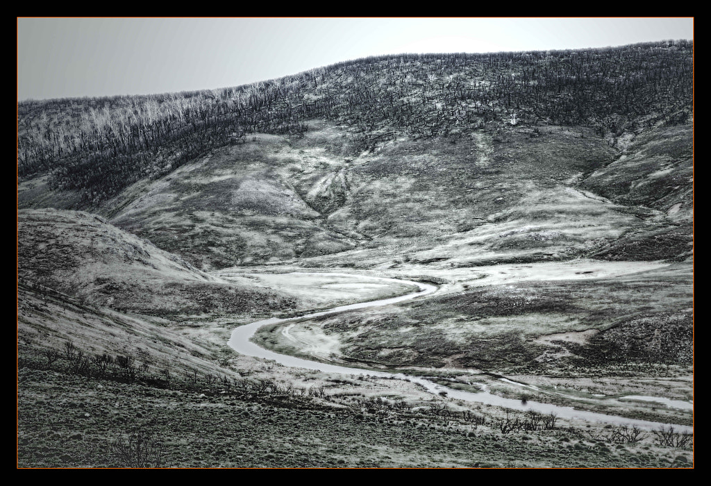
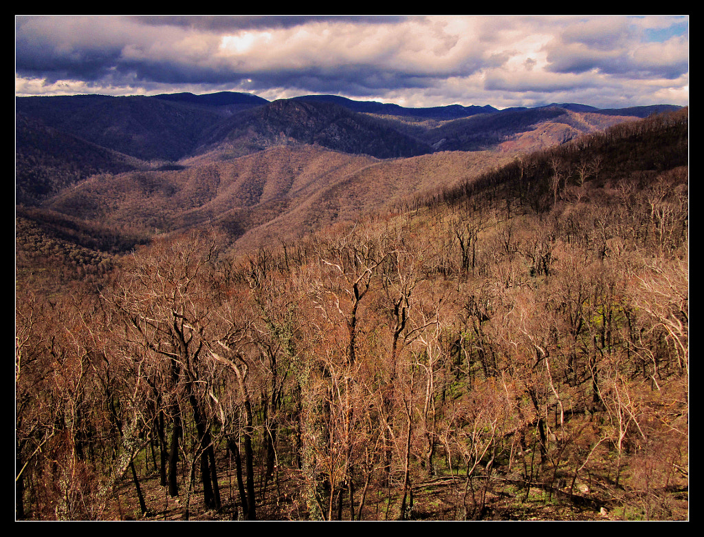
Funny that Come By Chance isn't mentioned on there, but it certainly helped our bearings. For all its past glory as a transport hub, it's pretty isolated out there & the landscape is an Australian cliché... you know the one


We soon left the black top behind, for some narrow dirt roads & only had one unscheduled stop due to an oncoming road train, who was about the width of the entire road... The driver seemed quite pleased we hadn’t panicked at his approach & had calmly got off the road while he was still about half a kilometre away. We got a wave as he thundered past at some impressive rate of knots, anyway... I'm still not sure how he'd got through the narrow gate we passed a few hundred metres down the road... it still looked intact

Not long after that, we disturbed some small birds by the roadside & unfortunately one of them will never be disturbed again - our windscreen was the shock of his life. L-SP was pretty shocked too - it hit on her side & she had visions of broken glass & a dead bird in her lap. Fortunately, Laura is made of tougher stuff. Well... not so fortunate for the bird, but...

After these encounters, we finally made it to what Laura called ‘Come By Chance Park’ which was a few hundred metres down another dirt road & was indistinguishable from the surrounding scrub & red dirt we’d been driving past for some time. Certainly didn’t look like anyone had been playing football or cricket there for a while... or ever. Either the park didn’t exist, or Laura had no idea where we were. I could see what looked like a small town a few hundred metres away, so abandoning Laura’s navigational conniptions, we found the right road &...


... really needn’t have bothered. The ‘town’ such as it was, was a few old & older buildings in various states of collapse & all seemed to be closed to visitors, whether they’d come by chance, or by dogged determination like we had. Oh well, at least we’d got some dirt on the tyres... windows, interior... & got a whole lot more when some white Toyota thing decided that 85kmh on a dirt road wasn’t fast enough for him & overtook us, leaving us literally in his dust, which totally obscured my view of the road, the side of the road... hell, even the sky!! Everything went white for about 20 seconds & I hit the brakes as we both coughed & swore at the rapidly dwindling shape of the arsehole as he disappeared in the fore-distance

Not long after that, L-SP got her wish of seeing a real Goanna, as it raced across the road in front of us, being chased by an angry magpie. Everybody is scared of Australian snakes, spiders & lizards, but don’t mess with our birds either... especially in nesting season!!

Walgett, when the dust had cleared & we could see the road, seemed a nice little town. Certainly the lady in the Visitors Centre was very helpful & happy, especially when warning us there was rain forecast for the north-western corner of New South Wales, which may put our planned route to Cameron’s Corner in jeopardy. We decided to press on regardless & adapt as we go, hoping we don’t have to. Cameron's Corner is where New South Wales meets both the Queensland & South Australia borders & we just wanted to be able to put a foot into both of those States, so we could say we've been interstate at a time when all the Covid19 restrictions mean that actual interstate travel is, if not actually banned, extremely problematic, as it involves a 2 week quarantine stay in a hotel, at your own expense, before you're allowed to go anywhere

The Corner is not really a major thoroughfare for interstate travel, as the dirt roads preclude most traffic &, if the expected rain hits, the roads will doubtless be closed. It can be an expensive exercise getting bogged out there - especially when the road's officially closed. You are charged $1000 per wheel that needs to be dug out, you pay for any damage you've done to the road & then there's the cost of getting the tow team out to you & the fee for dragging your recalcitrant arse back to the nearest town, which is Tibooburra - about 200 kilometres away. Not something we've budgeted for...

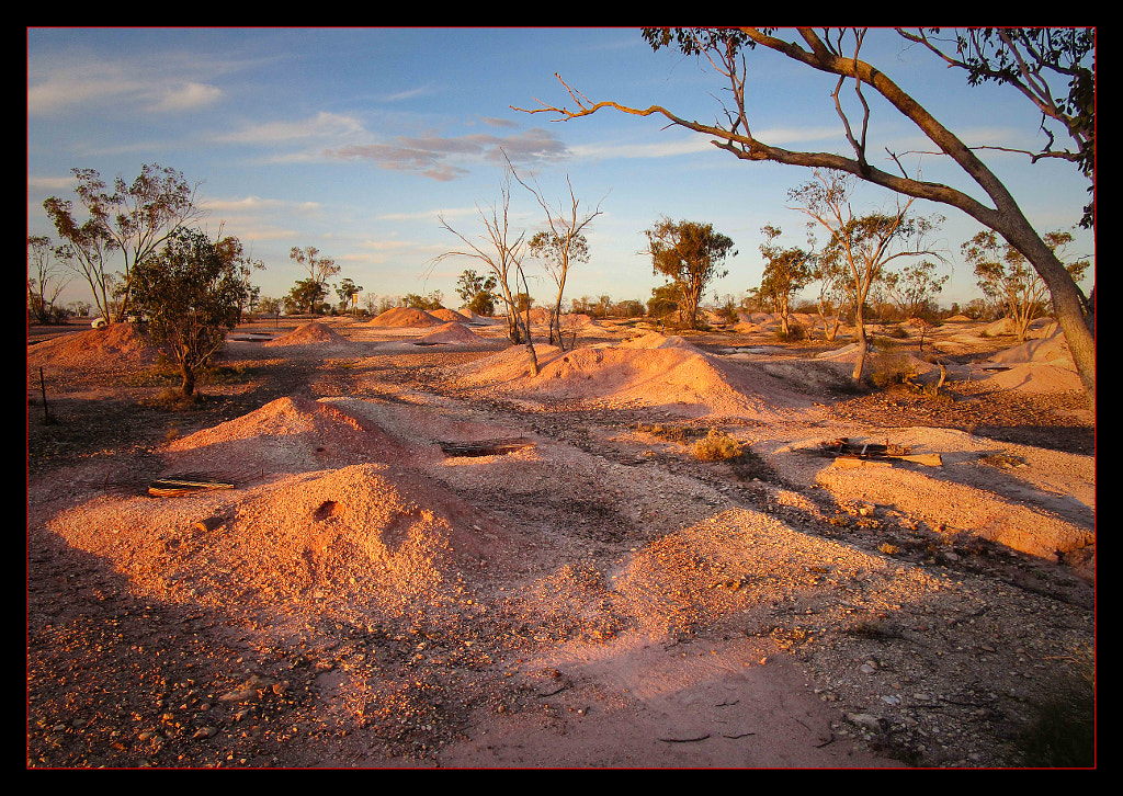
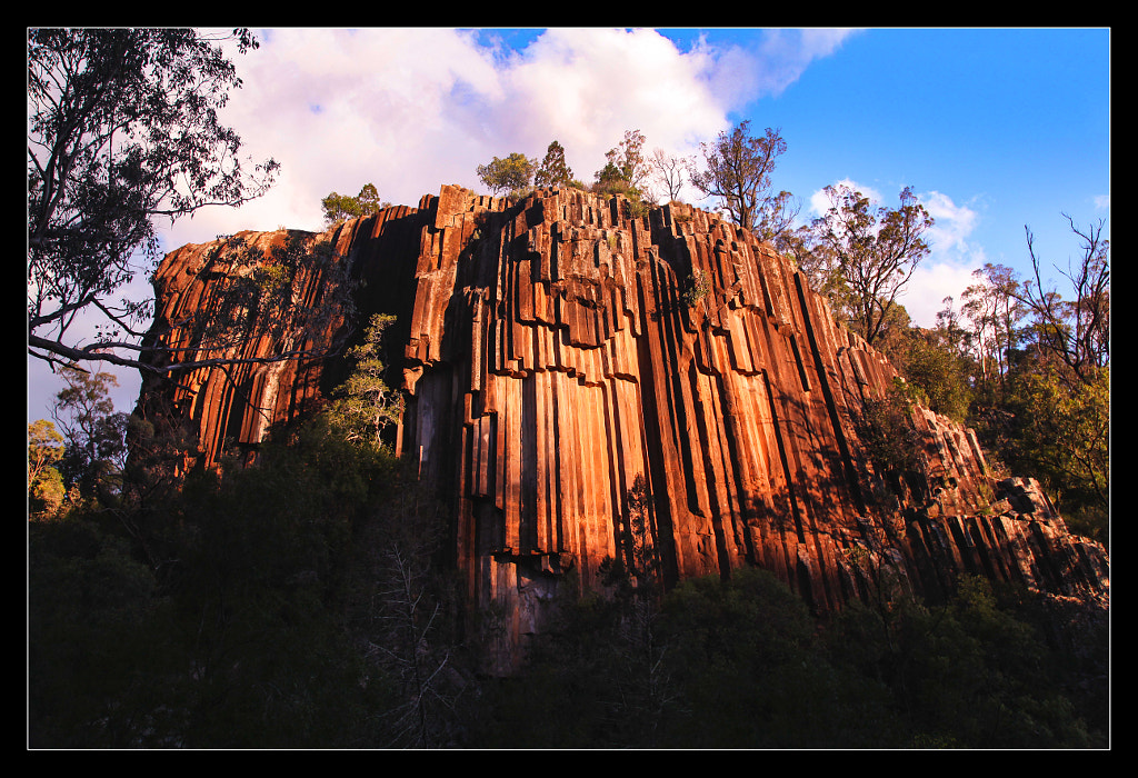
From Walgett, it's only a short trip down the highway to Lightning Ridge - the Opal Capital of Australia & boy, do they like to let you know!! From the moment you hit the 5 kilometre mark outside town, there’s nothing but roadside signs for opal mines, traders & tours. We found the Visitors Centre on the way into town &, again, the staff were friendly & helpful, recommending drive-yourself tours & various places. Given we’re here for 2 nights, it’s a good bet we’ll get to most of them. The drive-yourself tours are named after various coloured car doors. There’s a blue one, a yellow one, a red one... & the green one is the best to do at sunset, so, given it was about 4pm, we thought we’d start there. I’d noticed a sign for a green car door tour on the way into town & wondered what the hell that meant... now I know. It means about 20 minutes on a red dirt road full of ruts & potholes past & through small opal mine ‘claims’ which make the landscape look like a rabbit warren gone into overdrive, or a bit like the eastern end of the South Dakota Badlands, where the prairie dogs have holes everywhere... if the prairie dogs were the size of a young bison


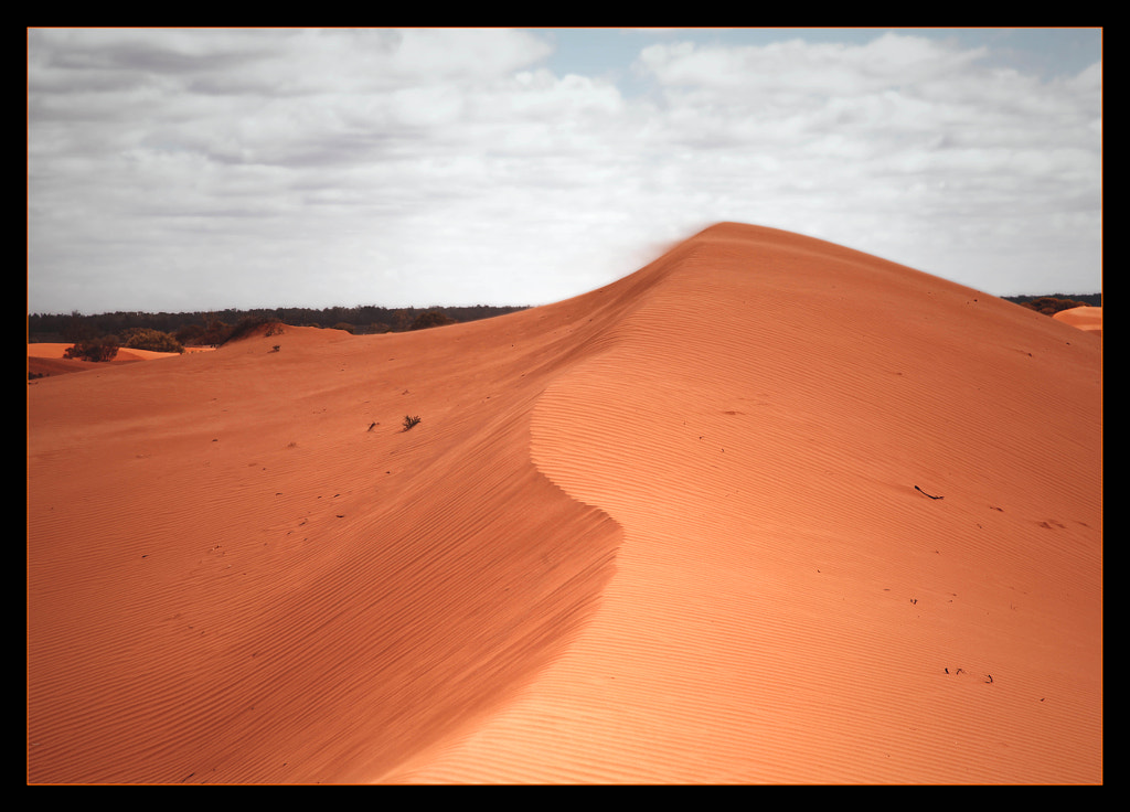
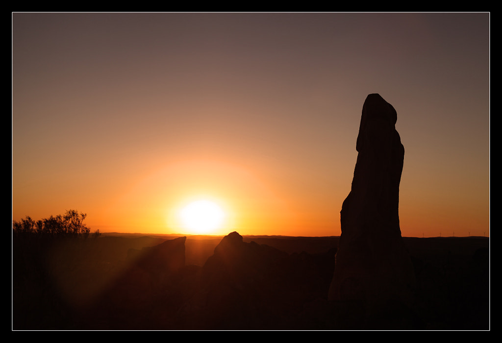
This was our first real encounter with the Red Centre of Australia in quite a few years & it felt good to know we were really out there & a long way from home. It’s a wonderfully liberating feeling

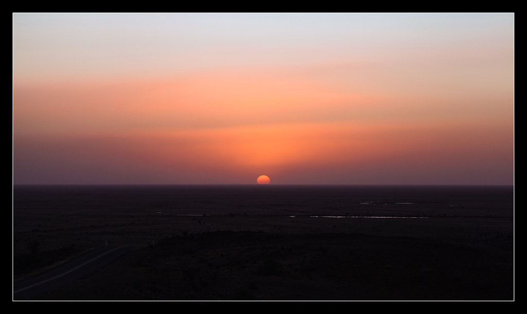
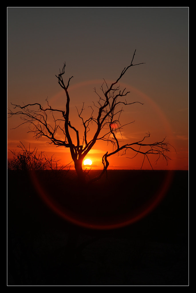
One that is apparently shared by a significant amount of Grey Nomad tourists, who seemed to converge on the end point of the trail, where the sunset view is written to be the best in town. We went from being pretty much alone, to waving away SUVs like the persistent flies all around. Fortunately, the view over the plains & the historic mine sites were quite interesting, even if the more recent addition of a ‘labyrinth’ made of small rocks arranged in concentric circles was not - though it certainly caught the attention of the increasing throng. Sunset, when it arrived, was nice, but not amazing... & certainly not improved by the soundtrack provided by one of the nearby SUVs pumping out an 80s power ballad, nor by the drone launched by another couple, which flew into my shots a couple of times. If there had been a suitable sized rock near to hand...

Lightning Ridge Sunset V by Justin B. on 500px.com

Back into town & more trouble with Laura’s navigation system. All we wanted was directions to a suitable restaurant. After a few U-turns & confusion, we headed for the town’s Bowling Club. It is something of an Australian country town tradition that, if there is a Bowling Club, it will have a Chinese restaurant in it - even if there's another Chinese restaurant elsewhere in the town. Lightning Ridge's club advertised ‘Lucky’s Brasserie’ which surely couldn’t be the local Chinese joint with a name like that, could it?

Yes. Yes it could... so far, so traditional. But it also did ‘Western Meals’ which were everything from steaks, fish & chips & a mixed grill of sirloin, chicken , bacon & egg, with chips & gravy, which my stomach cried out to

We plan to do the other coloured car door tours tomorrow & may, or may not, wind up down at least 1 opal mine. Who knows??

Kilometres travelled: 340 - though it felt like more...
waitingman: (Default)
Wednesday 16th of September
Odometer at 13,680kms

Up early, but maybe not as early as the alarm wanted us to be... some time after 6am, anyway. Last minute packing, playing Tetris with Laura’s boot space & on our way a little after 7ish. This meant that we were just about out of Sydney before the 8am school zones kicked in, though we did catch a couple of them around Hornsby & the last suburbs before the Hawkesbury River, which marks the northern border of Sydney

Rail Bridge by Justin B. on 500px.com


The plan was to have breakfast pies & coffee at Pie In The Sky, a recently discovered favourite stop on the old Pacific Highway, above Brooklyn. Arriving there at 8.30am, we found it didn’t open ‘til 9am, so asked Google for alternatives. The nearest one was in the industrial area outside Gosford & turned out to be more of a front for a catering company, than a place to get a good breakfast, so McDonald’s near Wyong it was, then...

Just outside of Newcastle, we turned onto the Hunter Expressway, which would normally mean we were hitting the wineries & cheese shops, but today, it was just the fastest way north-west to connect with the New England Highway. Past the Liddell coal-fired power station, past a few coal mines, racing a couple of those really looooong coal trains (If it blew its horn, it was called John, if not, it was Robbie. If there was a female driver, that was Alice), then through the old towns of Muswellbrook, Scone & a host of other small ones as we moved away from the coal mines & more towards agriculture, horse & cattle farming areas. After a couple of hours on the road, it was time to stretch the legs out & with no obvious photogenic location available, we found the town of Quirindi, found the local Information Centre, which was also the train station & an Arts & Crafts store, next to a giant grain silo, grabbed phones & cameras & went for an explore...


On the way out of Quirindi, I saw a sign for the ‘Who’d A Thought It’ lookout & we had to see it - just for the name alone! Turned out, it was a hill overlooking the town on one side & the fertile Liverpool Plains on the other. I’m not sure who’d have thought it, but we didn’t really think much of it. Great name for a lookout though - it certainly got our attention, so job done, I suppose


Through the town of (We’re all) Gunnedah & we reached our day’s destination - Narrabri - home to the CSIRO Compact Array Radio Telescope & after that, we consulted Google to see what else... It recommended the Sawn Rocks, about 40kms out of town, in the opposite direction to the telescopes, so we decided to visit those in the morning & headed for the hills. After an argument with Laura’s onboard navigation system, we found the right spot, just as a camera-toting guy was heading to the only other car in the parking area. According to him, the view was worth the 10-15 minute walk & the light was pretty good right now (about 4.30pm by this time). He was right! The pentagonal & hexagonal lava tubes stand about 40 metres above a creek bed & apparently, go another 30 metres below it. The setting sun was in the perfect position for us to go snap-happy with phones, point’n’shoot cameras & DSLRs for about 20 minutes, before the light began to fade & the giant mosquitos came out to feed on whoever was around. Given that was only us, we thought it high time to leave

Sawn Rocks by Justin B. on 500px.com


Dusk is kangaroo time on country roads, so L-SP kept watch on the left side & I scanned the right for any incoming movement... If Laura hit a kangaroo, it would not only be bad news for the ‘roo, it wouldn’t be too good for us either. Fortunately, the only one we saw was a joey which looked to be fresh out of the pouch, standing on the right side of the road & it hopped off into the bush as we approached, instead of trying to cross the road at the last minute, which is what all those kangaroos you see ‘resting’ on the side of Australia’s highways tried to do

The setting sun gave the horizon & evening sky a beautiful red glow, which made everything, even the coal trucks loading up on the outskirts of Narrabri, look kind of pretty. Unfortunately, there wasn't anywhere to pull over to get a good shot of it, which annoyed me, as I can't resist a sunset shot.... Back in town, we found the inevitable country Chinese restaurant, which at least had 2 Chinese staff AND some Asian people dining there, so that’s good enough for us!

Heading to Lightning Ridge tomorrow, after we call into the Compact Array...

Kilometres travelled: 700
Page generated Jul. 10th, 2025 04:47 pm
Powered by Dreamwidth Studios